
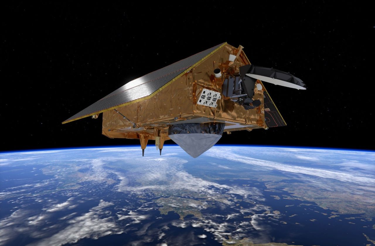
The Sentinel-6B spacecraft is the second of two Jason Continuity of Service (Jason-CS) missions, launching five years after its sister satellite, Sentinel-6A Michael Freilich. The Sentinel-6 satellites are the current generation in a long-running series of ocean topography satellites that began with the TOPEX/Poseidon mission, launched in August 1992. The series continued with three Jason satellites over the following decades before aligning with the European Union’s Copernicus program and adopting the Sentinel name.
The mission is a collaborative effort between space and environmental agencies on both sides of the Atlantic. The European Organisation for the Exploitation of Meteorological Satellites (EUMETSAT) will operate the satellite in partnership with the US National Oceanic and Atmospheric Administration (NOAA). NASA, the European Space Agency (ESA), and the distinct European Union Space Programme also have roles within the project.
Copernicus is the European Union’s Earth observation program. It uses a constellation of satellites with differing instruments and capabilities to build a detailed picture of our planet and its environment. Sentinel-6’s role is to measure global sea levels, wave heights, and ocean winds.
The new Sentinel-6B spacecraft will ensure the continuation of over 30 years of uninterrupted data recorded across the TOPEX/Poseidon, Jason, and Sentinel-6 satellites. After a year of concurrent lead-in operation, it will also take over Sentinel-6A’s role as the reference mission for other altimetry satellites, which will use its data to calibrate their observations.
You are currently viewing a placeholder content from YouTube. To access the actual content, click the button below. Please note that doing so will share data with third-party providers.
Sentinel-6B has the same suite of instruments as Sentinel-6A. Its primary scientific payload is Poseidon-4, a radar altimeter featuring a 1.2-meter parabolic reflector. Poseidon transmits a pulse of radio waves toward the Earth’s surface and records how long it takes for the signal to reflect back. This enables precise calculation of the distance between the satellite and the ocean surface. When combined with the spacecraft’s orbital parameters, the height of the ocean surface can be measured.
The Advanced Microwave Radiometer for Climate (AMR-C) measures radiation reflected from the ocean surface to monitor water vapor content in the atmosphere that might affect Poseidon-4’s readings, allowing an appropriate correction to be made to its data. AMR-C consists of two radiometers. The core AMR instrument measures the brightness temperature at three different frequencies: 18.7, 23.8, and 34 GHz, following on from similar instruments on previous-generation satellites. The High Resolution Microwave Radiometer (HRMR) was first flown aboard Sentinel-6A as an experimental system; it operates at frequencies of 90, 130, and 168 GHz, providing additional data expected to be more accurate in coastal areas.
It is key to Sentinel-6B’s mission that the satellite’s exact position in space is known at the point it takes each of its readings. To achieve this, the spacecraft carries the Precise Orbit Determination (POD) package, a suite of instruments dedicated to measuring the parameters of its orbit. This includes Doppler Orbitography and Radiopositioning Integrated by Satellite (DORIS) DGXX-SEV, which uses the Doppler shift of signals from a network of 55 ground-based beacons around the world to determine its velocity relative to those points on the surface.
The Global Navigation Satellite System Precise Orbit Determination (GNSS-POD) package uses a pair of receivers — one active and a cold spare — to determine the satellite’s position from navigation satellite signals. A Laser Retroreflector array is also part of the POD package to support ground-based measurements.
As well as using satellite navigation signals to determine its orbit, Sentinel-6B will use these signals and the way they interact with the Earth’s atmosphere to measure atmospheric properties. Global Navigation Satellite System Radio Occultation (GNSS-RO) payload uses two additional antennae to the one used by GNSS-POD to track signals from satellites close to the limb of the Earth — the horizon as seen from the satellite — with one antenna pointing forward and the other behind the satellite. The satellite studies how the signals are refracted as they pass through the atmosphere to build a profile of temperature, pressure, and water content.
The Sentinel-6B satellite has a mass of 1,190 kg, measuring 5.8 m in length, 2.4 m in height, and 4.3 m in width in a deployed configuration with its solar panels extended. It will operate in a low-Earth orbit (LEO) with an inclination of 66 degrees, an average of 1,336 km above the surface. From this orbit, it will be able to observe 95% of Earth’s oceans that are not covered with ice, repeating its track every 10 days.
SpaceX’s Falcon 9 rocket was Sentinel-6B’s ride into orbit, launching from Space Launch Complex 4E (SLC-4E) at the Vandenberg Space Force Base in California. The two-stage Falcon 9 first flew in June 2010 and has since made over 560 flights. Falcon 9 is partially reusable, with the first stage, or booster, designed to return to Earth for a controlled landing after separating from the expendable second stage.
Sunday’s launch was the third flight for booster B1097.3, which made its maiden flight at the start of September with the Starlink Group 17-8 mission. Its second launch came a month later with Starlink Group 11-39, and after both of these missions, it made successful landings aboard the Autonomous Spaceport Drone Ship (ASDS) Of Course I Still Love You in the Pacific Ocean. During Sunday’s Sentinel-6B mission, it was recovered once more, but this time returning to Vandenberg’s Landing Zone 4 (LZ-4) for a successful touchdown on dry land.
Sentinel-6B was the third mission in the Jason/Sentinel-6 series to be lofted by a Falcon 9: Jason-3 was deployed in January 2016 on the final launch to use the previous-generation Falcon 9 v1.1 configuration, while Sentinel-6A was also launched aboard a Falcon 9 in November 2020.
Airbus Defence and Space was the prime contractor for the satellite, which was built in Friedrichshafen, Germany. The satellite had been kept in storage under carefully-controlled conditions since construction and initial testing were completed in 2022.
The satellite’s journey to launch began in early 2025 when it left storage in Friedrichshafen. Following checkouts, the satellite was shipped in July by road and sea, arriving at Vandenberg Space Force Base on Aug. 18 for final preparations and integration with the rocket.
Propellant loading on the Falcon 9 began 35 minutes before launch. As the countdown proceeded, the oxidizer tanks continued to be topped off until they were pressurized at the T-1 minute mark in the countdown. The nine Merlin-1D engines that power the first stage began their ignition sequence at T-3 seconds. With the engines up and burning, the rocket launched when the countdown reaches zero.
After lifting off, Falcon 9 flew in a southeasterly direction following the coast of California, as it headed downrange. Seventy-two seconds into flight, Falcon passed through the area of maximum dynamic pressure, or max-Q, where it experienced peak aerodynamic forces. After two minutes and 13 seconds, the first stage engines shut down and Falcon 9’s two stages separated four seconds later. The second stage continued on to orbit with Sentinel-6B, while the first stage — B1097.3 — began its return to Vandenberg Space Force Base.
Eight seconds after stage separation, the second stage lit its engine: a vacuum-optimized version of the Merlin. About 23 seconds into this burn, the payload fairing separated from around Sentinel-6B at the nose of the rocket.
While the second stage fired, B1097.3 went through its own series of maneuvers. Immediately after separation, it reoriented itself for the boostback burn that put it on a course back towards the launch site. This burn began 13 seconds after stage separation, and lasted 48 seconds. Seven minutes and 22 seconds into the flight, it relit again for an entry burn, which helped to protect the booster as it passed back through the atmosphere. This burn lasted around 25 seconds.
B1097’s landing burn began about 49 seconds after the entry burn concluded, guiding the booster to a soft touchdown at Landing Zone 4. Landing occurred around nine minutes and 11 seconds after liftoff. Meanwhile, around the same time the booster landed, the second stage reached the end of its first burn and shut down its engines, with the mission entering a coast phase.
After the coast, the upper stage made a short second burn to circularize its orbit. This began about 51 minutes and 57 seconds into the mission, and lasted 11 seconds. About five minutes after the end of the second burn, Sentinel-6B was successfully deployed to begin its mission.
Source – NASA Space Flight (NSF)